

On the way to deceleration: Aigen-Schlägl - Schwarzenberg, 19 km


- Possible accommodation
Interactive elevation profile
Create PDF
Tour-Details
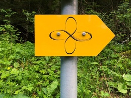
Path number: Gelbe Schilder mit Entschleunigungs-Symbol
Starting place: 4160 Aigen-Schlägl
Destination: 4164 Schwarzenberg am Böhmerwald
duration: 5h 6m
length: 19,3 km
Altitude difference (uphill): 290m
Altitude difference (downhill): 100m
Lowest point: 550m
Highest point: 740m
difficulty: medium
condition: medium
panoramic view: Great panorama
Paths covering:
Asphalt, Gravel, Hiking trail
powered by TOURDATA
Stage: Aigen-Schlägl - Schwarzenberg, 19 km
Along the Große Mühl you enjoy a relaxed first day as a start to your summit adventure. On the following days, you will hike a new summit on the Šumava ridge at over 1000 metres every day: Plöckenstein, Stinglfelsen, BärensteinEnjoy the different panoramic views, pause at the highest points in the Mühlviertel and recharge your batteries at these special places of strength.
Did you know that the forest develops its very own forest climate? Take deep breaths of the oxygen-rich forest air filtered through the trees and strengthen your immune system.
You can find the route digitally in the App Komoot.
We are also happy to provide you with a detailed description of the stage on request. This is also available for download under Multimedia/Documents.
With the free outdooractive app, you can hike the route using navigation.
further information:
- Possible accommodation
- Experience of nature
- Board possible
Details - hiking
- themed path
- Suitable for seniors
- Suitable for single travelers
- Suitable for couples
- Spring
- Summer
- Autumn
Please get in touch for more information.
Dreisesselbergstraße 18
4160 Aigen-Schlägl
Phone +43 5 07263 - 200
E-Mail boehmerwald@muehlviertel.at
Web www.wegderentschleunigung.at
https://www.wegderentschleunigung.at
You can also visit us on
Visit us on Facebook Visit us on Instagram Visit our videochannel on YouTubeInteractive elevation profile
Create PDF
Tour-Details
Path number: Gelbe Schilder mit Entschleunigungs-Symbol
Starting place: 4160 Aigen-Schlägl
Destination: 4164 Schwarzenberg am Böhmerwald
duration: 5h 6m
length: 19,3 km
Altitude difference (uphill): 290m
Altitude difference (downhill): 100m
Lowest point: 550m
Highest point: 740m
difficulty: medium
condition: medium
panoramic view: Great panorama
Paths covering:
Asphalt, Gravel, Hiking trail
powered by TOURDATA